
Return to the Wards' Home Page

| Three of America's great deserts--Mojave, Great Basin and Sonoran--meet in the Mojave National Preserve, which was established in October 1994. For Jim's birthday in April 2006, we explored parts of this impressive Californian desert with our son Martin. The Preserve is east of the town of Barstow, south of I-15 and north of I-40. |
|
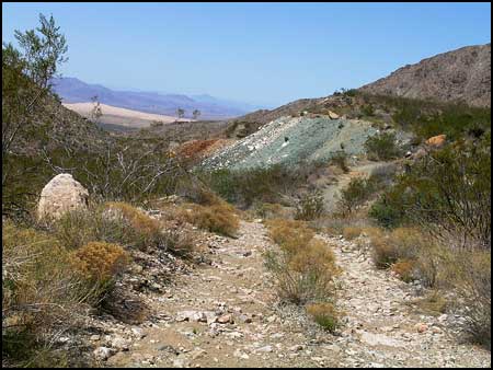
Naturally we sought the roads less-traveled. Foshay Pass met this criteria very well. It served the huge Vulcan iron ore mine operated by Kaiser Steel Mills from 1942 to 1948. Kaiser built the Liberty ships from ore mined at Vulcan. Colorful tailings, a large hole in the ground and old foundations remain to remind us of the history related to this mountainside. In the distant west, we could see the Kelso Dunes that rise 700 feet from the desert floor. Rose quartz particles give the dunes a golden hue. |
 .
.
| We camped along a barely visible road northeast of Foshay Pass. In the morning we hiked to find Blind Spring, a source of water for the early miners and ranchers in the area. There was a thicket of shrubs there, but no surface water. Some cattle remain in the area, but water is delivered to a tank at a corral near the top of the pass, and that is where the cattle like to be. |
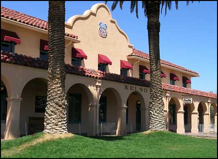
| Back in 1924, the Union Pacific Railroad built the Kelso Depot to service the steam engines that aided trains in climbing the steep Cima grade. The elegant Mission-Revival Style station was meant to compete with the Harvey Houses operated by the Santa Fe Railroad. The lunch room, the employee dormitories and the Ticket Office have been restored, and last fall the National Park Service opened the Depot as a Visitor Center and Museum. We enjoyed the displays and gained more understanding of the people who lived here on the desert in past years. |
|
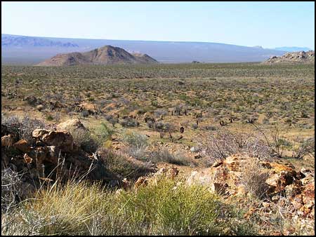
As we started up Macedonia Canyon on another dirt road, we looked across the desert to the north. The Mojave Road crosses behind the Marl Mountains, named for their clay composition and seen here at the top left. The Mohave Road was first an Indian trail, then an emigrant road, later a government road and finally a neglected road. In the early 1980s, four-wheel drive enthusiasts traced its route for 130 miles and put up cairns to mark the way. We have driven the road twice, and at the end of this trip we drove the segment of it covered by this photo (from right to left). At the right top skyline, note the distant mountains, then Teutonia Peak to the left of the mountains, and then a subtle rise or swelling that seems to level out on its left side. This is the Cima Dome, a geologic rarity in that it is the most symmetrical natural dome in the United States. It covers 75 square miles and is best viewed at a distance. The world's tallest and densest Joshua tree forest grows on the Dome. We passed through a portion of it on the Mojave Road. |

| In June, 2005, two lightning strikes started fires that joined and ultimately burned almost 71,000 acres. As we entered the burned area, we saw several flowers in bloom. Often wildflowers are more prolific after a fire. New yucca shoots were coming up from the roots and some shrubs were growing from the crowns. The cheerful Woolly Daisy pictured here occurs thoughout the Mojave Desert except high in the mountains. |
|
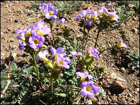
Fremont
Phacelia is commonly found in sandy or gravelly soils.
|
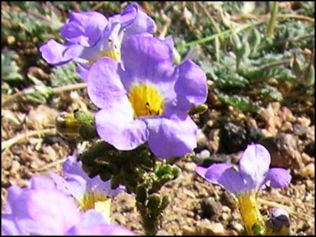
|
Here is
a closer look at Fremont Phacelia.
|
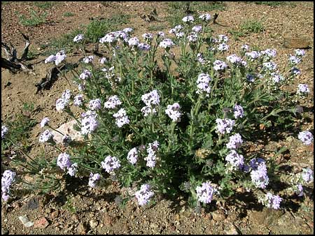
|
Goodding Verbena
is common in washes and on slopes above 4000 feet elevation, often associated
with pinyon-juniper and Joshua tree woodlands.
|
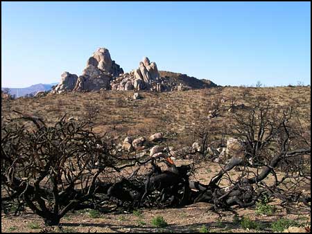
| The heart-breaking part of the burned area was the dead juniper and pinyon trees at about 5000 feet elevation. It will be many years before a mature woodland exists again. We entered the Mid Hills at the top of Macedonia Canyon and drove out along the rim to a campsite we had used before. Without the trees, the site was exposed and windy. |

| There were rare pockets of greenery to be found amidst the charred vegetation. We camped in the thicket visible at the top left. Long-eared jackrabbits were abundant in the area, more visible now because the bushes could no longer serve as hiding places. The hares rested in whatever shade they could find, then sprinted away as our trucks drew near. |
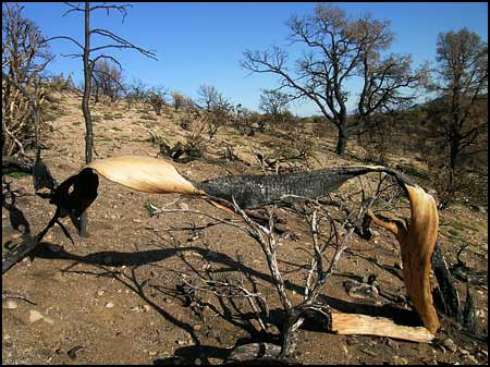
| High winds and heat from the fast-moving fire left stark sculpture. |
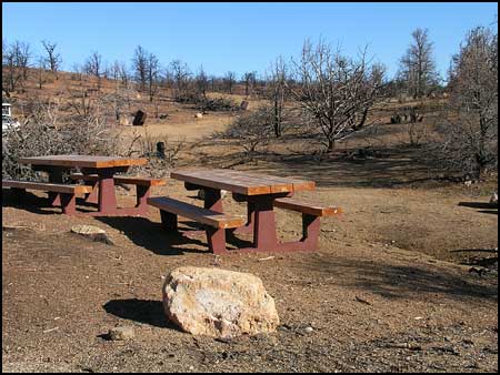
| Mid Hills Campground was 70% burned. It has been reopened for camping, and we were surprised by the number of people there. We preferred our sheltered site away from the crowd, but we remembered several other times when we enjoyed camping here with the lush green trees which are no more. |

|
We were anxious
to see if Government Holes survived the fire. The cottonwood trees have
grown since Martin first climbed the windmill for a picture in 1993,
and the windmill ceased functioning a few years ago. We wondered how
wildlife find water in this arid desert. The homesteaders and ranchers
who used to depend upon this well are no longer feuding over water rights.
Much of the ranching land is now a part of the Preserve.
|
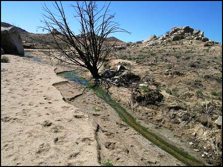
| We were surprised to find a stream trickling through the desert when we wandered out a dirt road to the old Barnett Mine, which was opened in 1911. It produced silver, lead and gold until 1915, when work became difficult due to too much water that couldn't be pumped out with the equipment available at the time. We saw more jackrabbits and some deer tracks, so it appeared that the wildlife is finding sustenance in the burned landscape. |

| On a lonely hillside near the mine we found a food cache, apparently made by a bobcat or a small mountain lion. We could see parts of a jackrabbit sticking out. We couldn't find tracks other than the scratch marks, and no animal was in sight. |
|
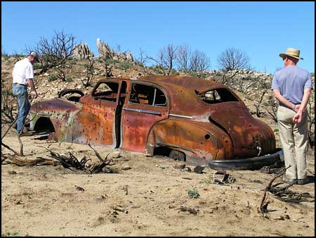
Not only was the fire one of the largest ever recorded in the Mojave, but it was followed by an unusually severe monsoon season. In July and August, nine inches of rain in four weeks caused many flash floods carrying sand, mud and ash. Perhaps this explains why the old 1947 Dodge is partially buried. Jim recognized the Dodge because he used to own one. The nameplate was melted into a lump visible on the bumper, but the outline of the word "Dodge" remained on the trunk lid because the metal had been protected from rusting by the nameplate. While the rains damaged roads and disturbed the terrain, they also encouraged re-growth of desert plants that were not known to re-grow or to germinate from seeds in response to fire. The rare occurence of a large desert fire followed by heavy rains provides an opportunity for scientists to learn more about desert ecology and for individuals like ourselves to look and wonder. |
|
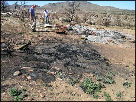
Questioning
who lived here and why, we examined burned schoolbus seats and other
household items.
|

|
Perhaps
this area was the workshop.
|
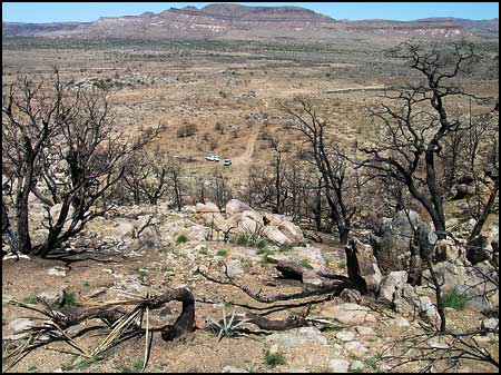
| Far above our vehicles at the burned shack, we looked down on the Pinto Valley and across to the New York Mountains with their wealth of old mines and rich history. As we climbed to this viewpoint, we saw where extremely heavy run-off had cut channels down the mountainside where someone had excavated mining prospects. |

|
Martin
climbed the rocks for a quiet moment and a higher perspective.
|
|
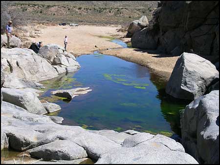
Rock
Springs provided a source of water for travelers along the Mojave Road,
although the amount of water varied widely with seasonal rains or dry
spells. Water from the valley above is funneled into this wash, seeping
through cracks in the granite boulders and forming a small stream that
disappears into the sand of the lower wash. When the flow is negligible,
bright green algae takes over. In 1866 an Army post was established
here, but it was no longer needed after 1868 when the U.S. Mail was
routed away from the Mojave Road.
|
|
Although
we spent much of our time viewing the evidence of fire in the desert,
our trip was enriched by the opportunity to see the re-growth of plants,
the return of wildlife and the continuation of peace and solitude that
the East Mojave has been known to offer. The new Visitor Center at Kelso
is an excellent place to begin a visit, for understanding the history
of the area is important in understanding the Preserve's role today.
|